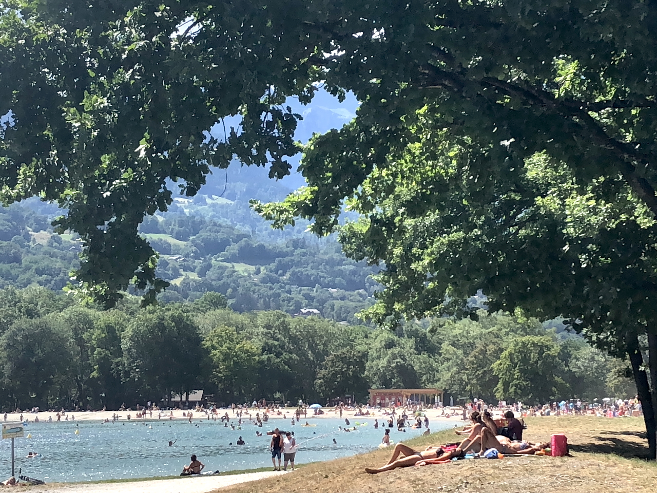
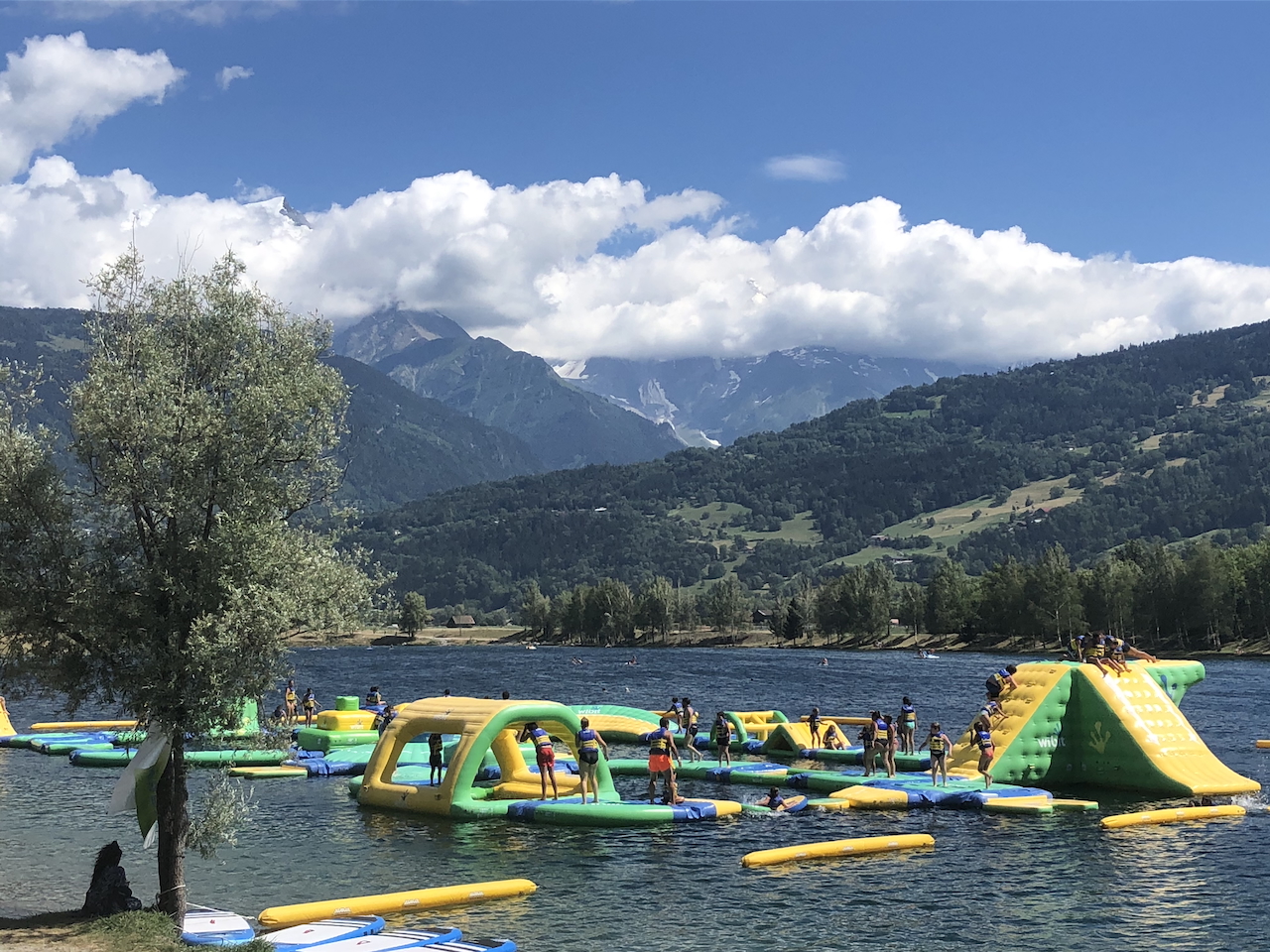
In road cycling, particularly cycling the Alps, in distance terms, cycling Chamonix to Lac Passy and then back is a relatively short route. This noted, with 981m of ascent, mainly on the return, cycling from Chamonix to Lac Passy and Lac Passy to Chamonix should not be underestimated or scoffed at. And there are two good reasons we have included it. The first is that it is simply a lovely cycling route, with the halfway point being the beautiful Lac Passy (Lake Passy), so great if you want to meet non-cyclists at the lake for a picnic, swim, lunch, etc. Secondly, some of the other routes we have included, start at Lac Passy. Why do we start them there, after 100kms plus of cycling, and often 2,000km+ of height gain, the extra, nearly 1,000m of ascent from Lac Passy to Chamonix can feel unforgiving for all but the strongest cyclists.



Cycling the Alps - Chamonix to Lac Passy


Cycling Chamonix to Lac Passy and Back
Cycling the alps – Starting in the Centre of Chamonix
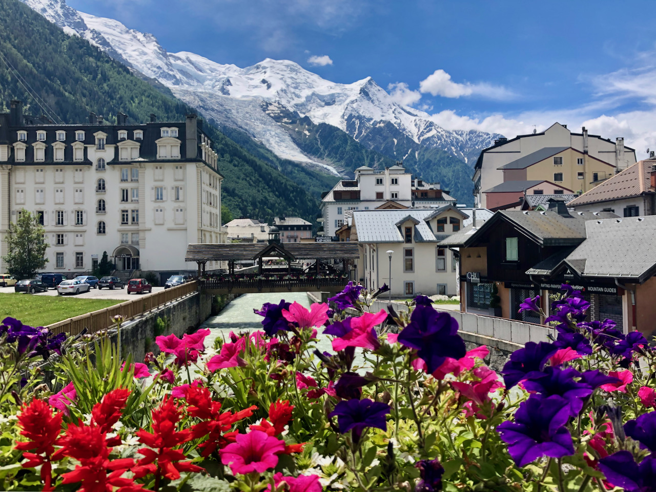
As you will see, we have started this route from the Place du Mont Blanc in the centre of Chamonix. Your route will depend on where your chalet is booked: Les Houches is closer, and Argentière is slightly further. Regardless, to coin the sporting terms, this route is a tale of two halves. The first half is pretty much, give or take, all downhill, with the second half, on the return, being mostly uphill. Although it is a good climb, as we noted earlier, circa 800m+ on the way back, most of the climbing is in the easier zones that make it accessible for most sports, and good recreational cyclists. But you decide based on your knowledge of your fitness and subsequent ability.
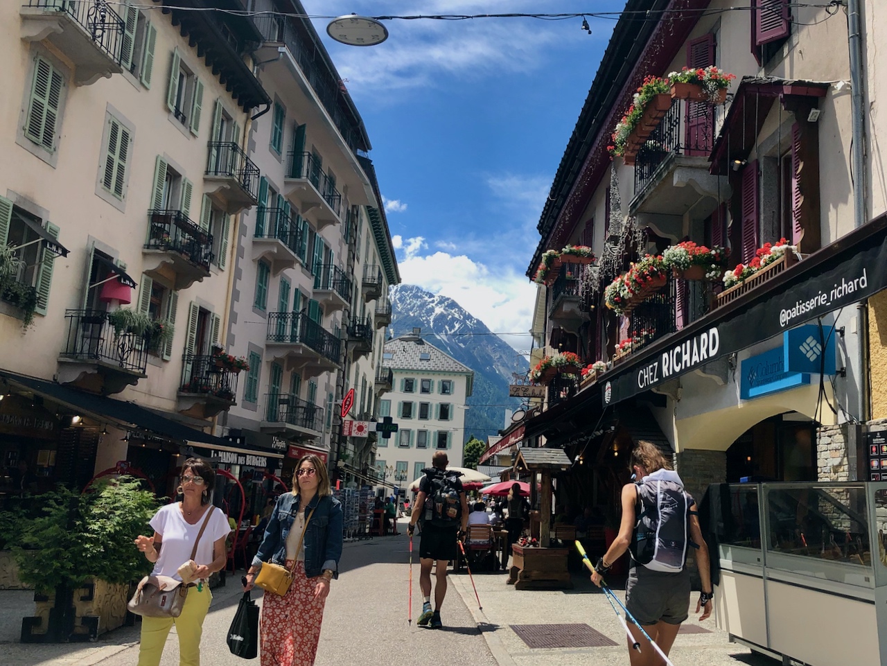
The benefit of Chamonix cycling is you can use the cycle path that stretches from one side of Chamonix to the other (safest route), although we prefer to use the back roads. Therefore, we cycle past the bakery Chalet 4810 on the left, and around the small ring road Allee Recteur Payot. Across the first roundabout, past the Gendammerie on the right, down the slight incline, before taking a right at the next roundabout heading towards the Gaillard lakes (D243). From here, we stay on this route to Les Houches. Continuing through this village until we reach the Bellevue lift station on one’s left. Here we take a left (straight on but across the road that now turns to the right), towards the Prarion lift station. Under the Kandahar World Cup ski bridge 300m further along, and when you get to the roundabout by the aforementioned Prarion lift station, take the second exit towards Vaudagne. 500m along this road, it sweeps to the left and up towards the Maison Neuve, but you will need to continue straight on towards Vaudagne and the day’s first climb that is straight in front of you. It doesn’t look too bad, and in terms of distance, it isn’t, just 1.65km, but it deceives the eye as it averages 7% and a cycling height gain of 116m. From a numbers perspective, we appreciate that it is not a lot. Still, perhaps because it looks so lovely, alpine trees and rocks left and right, and also appears more straightforward than it is, it wakes the system quicker than expected, especially as the steepest part of the climb is in the first third.
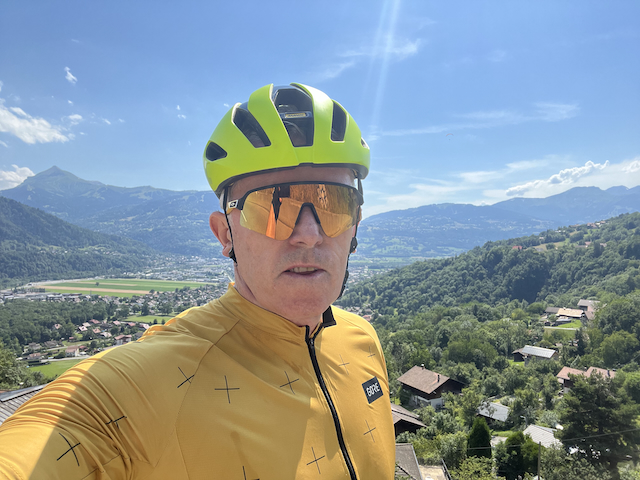
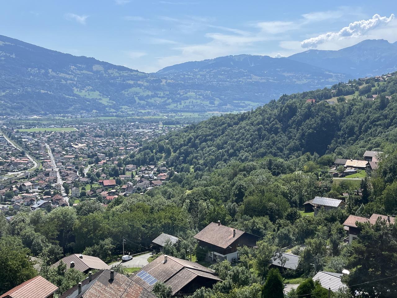
At the top of Vaudagne, you will now head down towards Servoz. It is a fast descent in places, with a couple of really sharp hairpins. One in particular always seemed to catch us out for a long time, either braking late, extremely hard, or ending up on the wrong side of the road. So please be careful, we have been lucky not to find a car coming the other way. Once through Vaudagne you will come out by the A40. Cross this via the bridge, follow the road to the right, and then take a left towards Servoz at the top of a minor incline. You will now head on and through Servoz, staying straight ahead and ignoring turns left and right. Leaving Servoz you have some undulating terrain before you have a lovely, gradual incline towards Passy and Sallanches. On your left are magnificent views of these two towns below (see photos above). Continue on and through the pretty village of Joux, crossing over the roundabout and descending towards Chedde and then Passy after Chedde. Keep heading towards Les Regards, avoiding the left turns at first and then the right up toward Plan Joux. About 500m after Les Regards is the D199, referred to as the Route de la Crabote, which is easy to miss, so look out for it. This will take you down to a roundabout, where you cross the Avenue de Saint Martin. This is quite a busy route by alpine cycling standards (but not by large town and city benchmarks), so slow down when crossing the roundabout. Lac Passy is over the bridge that crosses the A40, and 500m on the right. As you run parallel with the lake on your left, and the railway track on the right, halfway down is a lovely bistro/restaurant that you can sit outside, and enjoy a drink or two. There is also a great water park area if the family, with younger members, are meeting you down there close to this drinks and food stop, so popular with all.
Cycling Back to Chamonix from Lake Passy
The return is the reverse of the route that you came down. It is a good climb back about 29km, and well over 800m, close to 900m of ascent, as we have already said. We won’t cover the route in detail again, being the just the reverse, but instead just point out the inclines to be prepared for. The first cycling climb being is as soon as you cross the first roundabout. It is not steep gradient wise, except at the start, but it is 310m of climbing over 7.5km of cycling distance (see gradient below):
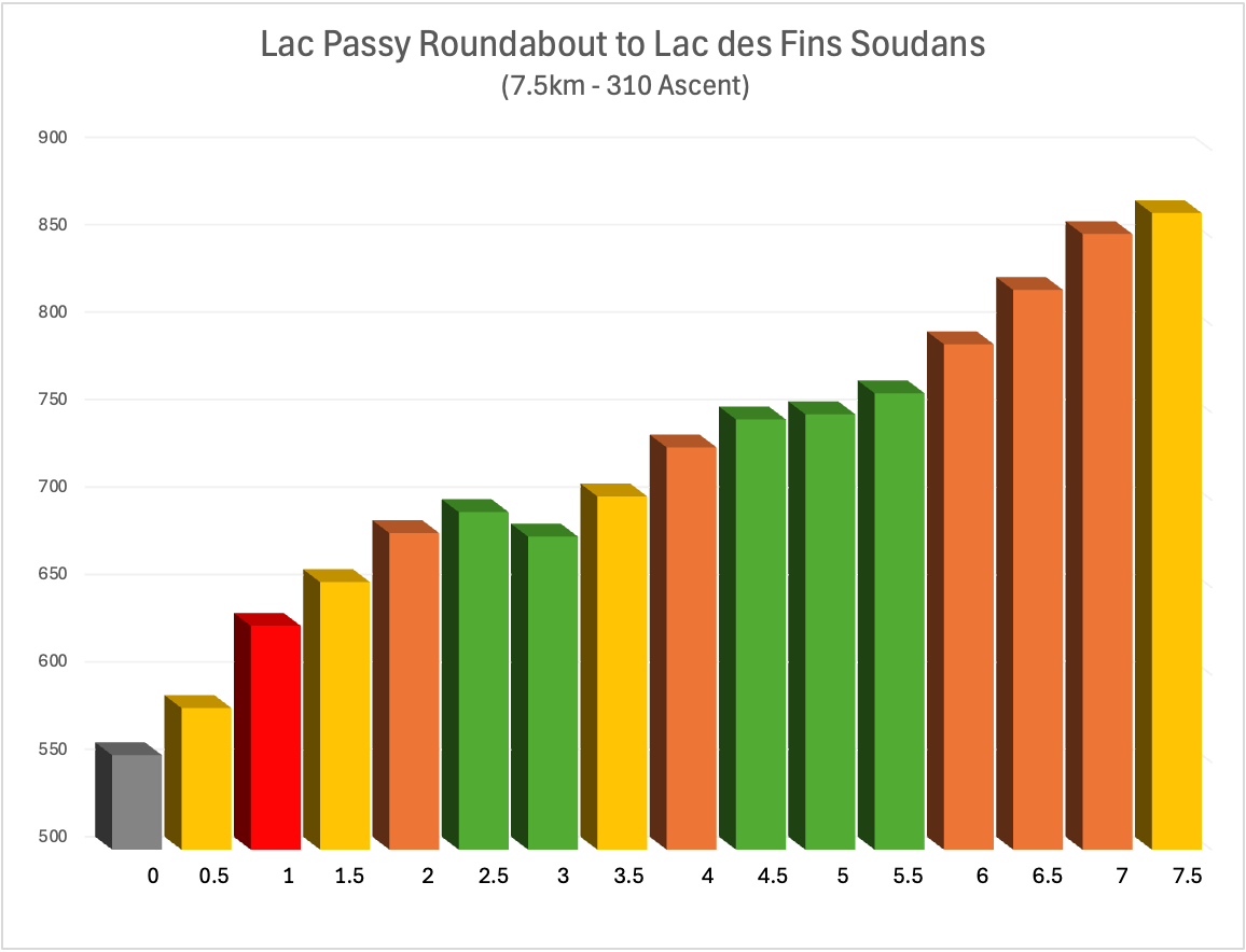
It might just be us, but this climb’s last 1 or 2km should be the easiest. It is negligible ascent gradient-wise, but it seems the hardest. Seeming to just keep going. Strangely, earlier steeper sections feel easier for some reason! Anyway, you are now heading on towards Servoz. Through the village, along, up and out towards the A40. You will know you are close to this main route when you hit the incline affectionately known as the Mule locally. Less than a kilometre long, circa 700m, and just 31m of height gain, it kicks, we think, because you are not actually expecting it.
Vaudagne Cycling Hill Climb
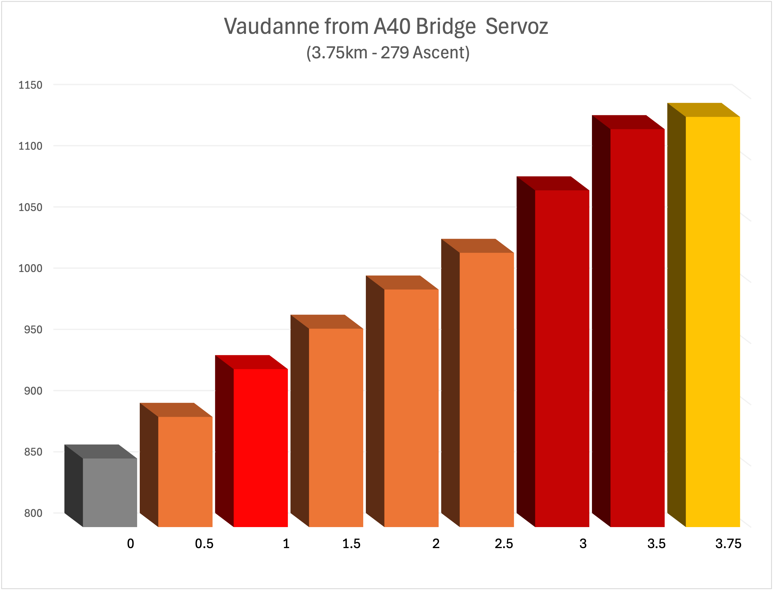
Once across the A40 bridge, you will be about to take the final climb, the Vaudagne cycling hill climb. Strangely, despite this being a Category 4 climb, 3,5km long, 7% average gradient, and just under 300m of ascent (279m), it seems relatively straight forward as you weave through this pretty mountain village, before enjoying the short descent into Les Houches.
Now, you can ease back into the saddle and enjoy the last few km back to your favourite Chamonix Chalet that you’ve booked for your cycling holiday. We hope you enjoy it. Please leave your thoughts in the comments box below.
Cycle Stats, Ratings, and Garmin Connect Map:
Distance:
Ascent:
Cycling Level:
Estimated Time:
Hill Climbing:
Scenery:
Roads / Cycle Paths:
Cafe Stops:
Overall (Enjoyment):
58km
981m
Sports Cyclist
2½ - 3½ hrs
🚲🚲
🚲🚲
🚲🚲
🚲🚲
🚲🚲

Contact Us:

Connect With Us